
Introduction:
When it comes to understanding the Earth’s geography, there are many concepts to grasp. Two of the most important, yet often misunderstood, terms are altitude and latitude. These concepts help us understand the Earth’s surface and are essential for navigation, climate studies, and many other applications. In this post, we will explore the differences between altitude and latitude, their significance, and how they impact various aspects of our world.
Before we go!
Some people confuse one of these terms (altitude and/or latitude) with longitude, which is one of the two (the other being latitude) geographic coordinates that help us identify and locate any point on the Earth’s surface. Indeed, latitude and longitude are the two sides of the same coin. On the other hand, altitude, albeit related, is an entirely different concept.
Still confused? Don’t worry; we have got you covered. You can find a quick rundown of the difference between latitude and longitude at the end of the post.
Altitude: The Vertical Dimension
Altitude refers to the height of an object or location above a reference point, typically sea level. It is a vertical measurement expressed in units such as meters or feet. Altitude plays a significant role in various aspects of our lives, including:
Climate: Higher altitudes generally experience colder temperatures, as the air becomes thinner and is less effective at retaining heat. This is why mountain peaks are often covered in snow, even in warmer seasons.
Air pressure: As altitude increases, the air pressure decreases. This is because there are fewer air molecules at higher elevations, resulting in less atmospheric pressure. Lower air pressure can affect human health, leading to altitude sickness in some cases.
Aviation: Pilots must account for altitude when navigating and calculating fuel consumption, as air pressure and temperature variations can impact an aircraft’s performance.
Latitude: One of the Horizontal Coordinates
Latitude is a geographic coordinate that indicates the north-south position of a point on the Earth’s surface. It is expressed in degrees, minutes, and seconds, with the Equator representing 0° latitude, the North Pole at 90° North, and the South Pole at 90° South. Latitude is significant for various reasons, including:
Climate: Latitude has a strong influence on climate, as different latitudes receive varying amounts of sunlight throughout the year. Generally, areas closer to the Equator experience warmer temperatures, while areas near the poles have colder climates.
Daylight hours: The length of daylight varies depending on latitude, with areas near the Equator experiencing relatively consistent daylight hours throughout the year. Meanwhile, regions closer to the poles can experience extreme variations, such as the midnight sun in summer and polar night in winter.
Agriculture: The types of crops that can be grown in a region largely depend on its latitude, as it determines the climate and growing conditions. For example, tropical crops such as bananas and coffee require the warmer temperatures found near the Equator, while wheat and potatoes thrive in temperate zones.
Understanding the Relationship
Altitude and latitude are distinct concepts, but they can be interconnected in various ways. For instance, the impact of altitude on climate can be more pronounced at certain latitudes. High-altitude locations closer to the Equator, such as the Andes Mountains in South America, can have milder climates than those found at similar altitudes closer to the poles. Additionally, both altitude and latitude can have a combined effect on ecosystems, resulting in unique biomes found only in specific geographic areas.
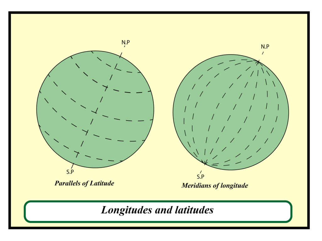
Latitude and Longitude Difference
Latitude and longitude are both geographic coordinates that help us identify and locate any point on the Earth’s surface. While latitude indicates the north-south position of a location, longitude represents the east-west position. Together, these two coordinates create a grid system that enables accurate mapping and navigation across the globe.
Longitude lines, also known as meridians, run vertically from the North Pole to the South Pole. The Prime Meridian, which passes through Greenwich, England, represents 0° longitude, with values increasing up to 180° East and 180° West. Longitude coordinates help determine time zones, as the Earth is divided into 24 equal segments, each representing a one-hour time difference.
In contrast, latitude lines, or parallels, run horizontally, encircling the Earth parallel to the Equator. As mentioned earlier, the Equator represents 0° latitude, while the North and South Poles are at 90° North and 90° South, respectively. Latitude plays a significant role in determining climate, daylight hours, and agricultural patterns.